


John Muir Trail below Donohue Pass.
A summer goal of mine has been to explore more of the Eastern Sierra that surrounds my home in Mammoth. With hundreds of miles of backcountry trail headed in every direction, sometimes it’s a struggle to decide which route to take. Not really the worst problem to have.
The Plan
Cover the classic John Muir Trail between Tuolumne Meadows (Yosemite National Park) and Agnew Meadows, which is just 4 miles from Mammoth Mountains Main Lodge. A total of 26-28 miles with roughly 4100ft ascent/4500ft descent, the route climbs over two Sierra passes, has a maximal height of 11,056ft, and circumnavigates numerous high alpine lakes with unforgettable views. Typically it’s run south to north, with a finish in Tuolumne, but, I didn’t have all day to play in the Valley.

The route. Photo red: thebesthiking.com
Morning Of
I awoke at 5:45am and had my usual breakfast and coffee before a short walk to catch the YARTS bus (Yosemite Area Regional Transit Systems) about a half mile from my house. For just $9 you can take this charter bus from Mammoth Lakes to Tuolumne Meadows (48 miles) which includes your Yosemite Parks entry fee and a very scenic commute; around June and Silver Lake, through Lee Vining, up and over Tioga Pass and into Tuolumne Meadows.

June Lake.

Silver Lake

Tioga Pass.
On the ride over I chatted with another local headed to the Valley floor and a backpacker that planned to hike the same route I was about to run.
When I told him I was to run from Tuolumne to Agnew he curiously asked how long it would take.
“About 4 hours”, I replied.
“What?!” He responded with wide eyes. “I’m doing it in 3 days…”
Tuolumne Meadows
I departed the bus and walked the half mile or so from Tuolumne’s General Store to the JMT trailhead at the back of Tuolumne Meadows Campground. As campers stirred and the smells of bacon and coffee drifted through the campground, I packed 1L of water, 3 Roctane Gels, and a Wanderlust UgoBar into my pack and I was ready to head home.

JMT Trailhead from Tuolumne Meadows Campground.
A recent series of thunderstorms had given way to a perfectly crisp alpine morning and I comfortably ran with a light jacket the first few miles. The trail parallels the river through Lyell Canyon on perfectly packed 12-18 inch wide single track evident of many years of foot travel throughout the Eastern Sierra. You quickly forget being in the high country as there is hardly a blip of elevation change throughout the meadow.

Lyell Canyon Meadow.
As I ran, a dozen or more deer glanced up and gave me the ocular pat-down before they returned to their breakfast. Several small groups of hikers headed both north and south along the trail, many looked worn down and ready for reprieve.
-

Halfway up the climb to Donohue Pass.
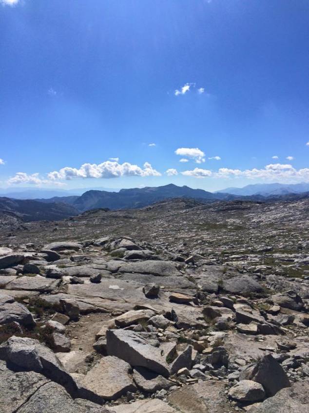
The first climb
Around 10 miles you begin the ascent from 9,000ft to over 11,000ft in less than 4 miles towards Donohue pass. The pass also marks the boundary between Yosemite National Park and the Ansel Adams Wilderness.
It doesn’t take long before power-hike mode kicks in. High steps line the granite staircase that lead upward towards the sky and the local marmot population begin to litter the trail with great frequency. This would be my slowest mile of the day.

The last alpine lake prior to Donohue Pass.

One of the final staircases towards the pass.
As I crested the pass there were more than two dozen backpackers congregated into small groups catching their breath. 24 hours ago, they would’ve served as lightning rods for a natural July 4th firework show.
-
Donahue Pass; 11,056ft.

Without a stop, I darted down the eastern slope as the hikers joked about how I needed more weight in my pack. The next 4 miles drop nearly 2,000ft over very rough, joint pounding granite steps before a reversal into the short and steep climb over Island Pass.

A wildflower meadow before Island Pass.
Thousand Island Lake
Thousand Island is an iconic backcountry location in the Eastern Sierra and you reach the eastern end of the lake around 19.5 miles. This is where the JMT and PCT split, and you choose your fate as to which descent you will take into Agnew Meadows.

Banner Peak and one of the half dozen log bridges traversed along this section of the JMT.

Banner Peak and the lower section of Thousand Island Lake.
I opted to stay south and continue on the JMT towards Garnet Lake. After a quick pass of Emerald Lake and switchbacks up and around Ruby Lake, you take a sharp and steep 1 mile rocky descent towards Garnet.

View from Garnet Lake towards the PCT across the valley.
Rookie Mistake
As you cross the foot bridge along the eastern end of Garnet (about 21.6 miles in, and 3:19 into my run) I regretfully decided to branch off of the JMT and take a “new” trail that I had spotted. This use trail descends abruptly along loose talus as it directly parallels the Middle Fork of the San Joaquin River. Probably used only by game and foolish runners/hikers like myself, my run soon turned into a bushwhacked and tree scramble festival.
However, no more than a mile later did I stumble upon 4 people stationary in an open meadow, phones in hand. I quickly noticed their running packs, moon-shoes, and knew they were of my own kind.
Turns out this group of 4 Santa Barbara Running Co. folks were quite lost and nearly 6 hours into their attempted run from Mammoth Pass to Silver Lake. They were very far from Silver Lake.
So I paired up with them, lead the final 4 miles out of the dense forest, back onto the JMT, around Shadow Lake, and into Agnew Meadows where the five of us caught the bus back up to Main Lodge and into Mammoth ($7; or you can run/hike the final 3 mile climb to Minaret Vista and be picked up there. Free shuttles run from Main Lodge throughout all of town) .

Made a few friends on the trail.
Bucket List Run
An absolute must for any runner on the Eastside interested in a long High Sierra run. The logistic ease of doing a point to point 45k run over mountainous backcountry terrain is next to none. But don’t be fooled, the mixture of high altitudes, steep climbs, and technical terrain make for a high difficulty overall.
That said, you will be hard pressed to find a more rewarding route.
Gear/Stats
Kiger Pack
1L water, 3 Sea Salt Chocolate Roctane Gels, 1 Wanderlust UgoBar


Did you (do you) need a wilderness permit for this? Can a couple of JMT newbs do this trail and not get lost?
No permit needed, unless you spend the night. Yeah, news could do it. But grab a map, study it, and take it just incase.